Heat Ahead Triggering Early Summer, Likely Increase In Wildfires
Temperatures around the region are close to normal right now but will be climbing by the end of the week.
The 8-to-14 day forecast from the Climate Prediction Center shows an 80 percent chance of warmer than average weather.
Greg Kock with the National Weather Service says it's the beginning of a trend.
"That combined with the outlook for June, July and August favoring above average temperatures would suggest that summer will be arriving early for the inland northwest this year," said Koch.
The warmest weather ahead in the short term could be a week from Wednesday, when Wenatchee, Omak and Moses Lake could reach 95 degrees.
With a heatwave on the way, there's interest in what that means for wildfires.
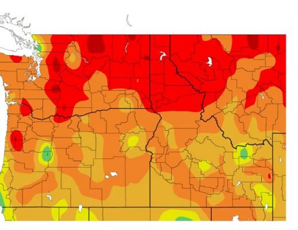
Currently, the National Interagency Fire Center predicts there'll be above average wildland fire activity in July and August for the eastern slopes of the Cascades.
Kock says that forecast could change.
"Given that we have had a warmer than average May, and lost our mountain snowpack very quickly this month, there may be some changes to that fire outlook coming out tomorrow," Koch said.
He said the land area with above average wildfire activity could be expanded to include most of eastern Washington.
The National Interagency Fire Center does an outlook for the summer fire potential each year.
The outlook is based on the long-range outlook for weather as well as conditions going into the fire season, including snowpack, long-term drought and the status of debris and fuels in the forest that can trigger fires.
The warm weather on the way is not expected to break any records in eastern Washington, at least in the first week.
More From 99.5 The Apple